


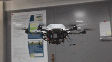
Walking robots are improving all the time. But navigating unknown terrain still remains a challenge. As the below video shows, it is possible to using a drone with a camera to map the visual features of an area and make the data available to the walking robot. The elevation map is analyzed for slope steepness, locale roughness, step height, and other factors to come up with a path to the goal position.
Currently Trending Geeky Gadgets
Collaborative Navigation for Flying and Walking Robots

The elevation map is continuously updated to allow the walking robot to get to its destination. The above video shows how this collaborative navigation system for robots works.
[Source]
**Disclaimer: Our posts may feature aff links. As an Amazon Associate, we earn from qualifying purchases. Please read our disclaimer on how we fund this site.


