


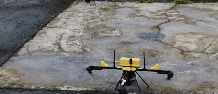
When it comes to mapping drones, you will want to invest in a UAV that can withstand challenging conditions. The Q6 V2 GEO is a new mapping UAV that that can handle complex urban environments and even glacier in the Himalayas. It has a modular design with interchangeable payloads, including Shodham M61, M3D, LXT, and LAV for hyperspectral imaging and thermal detection.
Currently Trending Geeky Gadgets
Q6 V2 GEO | Map Where Others Can’t

This drone can be used to build 3D city models and perform tower inspections. It can also be used in aids disaster response. It can operate in temperatures from -20 to 50C. Operators can fly multiple drones at the same time and manage missions in real-time. With airborne data relay, it is easier to map remote and mountainous regions.
[HT]
**Disclaimer: Our posts may feature aff links. As an Amazon Associate, we earn from qualifying purchases. Please read our disclaimer on how we fund this site.


